Great Walks In Tongariro National Park (Apart From The Crossing)
Great walks in Tongariro National Park (Apart from The Tongariro Alpine Crossing!)
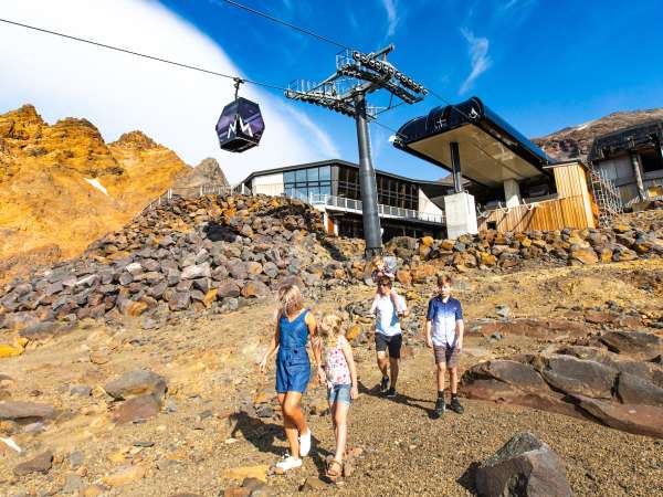
Iconic and legendary, the Tongariro Alpine Crossing is undoubtedly the most well-known and popular hike in the Tongariro National Park.
However, it is certainly not for everyone. It is after all, a 19.4km hike across a volcano and so is challenging for most people, and a near impossible feat for some. With a couple of steep inclines and uneven terrain, it’s important not to underestimate the energy zapping might of this track!
Fortunately, there are heaps of other excellent walks and tracks of a variety of types and lengths in and around the Tongariro National Park for those who can't or don't want to do the Crossing. These are also great alternatives for those who've already done the Crossing or have a day or two up their sleeves before or after tackling it.
Here are some of other great walks in and around the Tongariro National Park to do, instead of, or in addition to, the Tongariro Alpine Crossing.
Mangatepopo to Soda Springs
You don't have to hike the full-length of the Tongariro Alpine Crossing to experience some of its splendour. A good alternative is to walk the first section of the track along the Mangatepopo Valley to Soda Springs. Mangatepopo Valley is believed to have been glacially carved out during the last ice age and subsequently partially in-filled by lava flows from Mt Ngauruhoe. This landscape makes it well worth a visit in its own right. The walk starts from the Mangatepopo carpark and sets off through fields of yellow tussock before climbing at a gentle gradient alongside a stream and around the edges of old lava flows. The valley ends at the foot of Mt Ngauruhoe, where you're treated with up close and personal views of this iconic volcano. From here a short side track leads to Soda Springs where clear, cold water cascades into a small stream. The water is slightly charged with dissolved gases and this effervescent quality inspired the name. Allow 3 hours for the return journey, which makes it a perfectly timed with the parking time limit at the Mangatepopo carpark.
Distance: 8km return
Grade: Easy to moderate
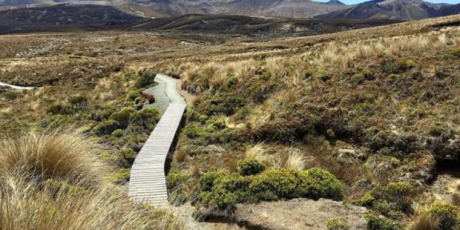
Tama Lakes
In distance and unique scenery, the hike to the Tama Lakes is a very close rival to the Tongariro Alpine Crossing. This 17km track crosses a distinctive undulating landscape of tussock and alpine herbfields to the Tama Lakes. With very few ascents, apart from a steep incline to 1440 metres to the upper lake viewpoint, it's a far less arduous hike than the Crossing. Flanked by Mt Tongariro and Ngauruhoe on one side and Mt Ruapehu on the other, the views along this walk are truly exceptional. On a clear day, you might even be lucky enough to spot Mt Taranaki on the western horizon. The Tama Lakes occupy several old explosion craters on the Tama saddle between Mt Ruapehu and Ngauruhoe and are well worth the trek to view. The walk starts and ends in Whakapapa Village with access on Ngauruhoe Terrace, behind the Chateau Tongariro Hotel.
Distance: 17km return
Grade: Moderate, with a steep ascent to the Upper Lake.
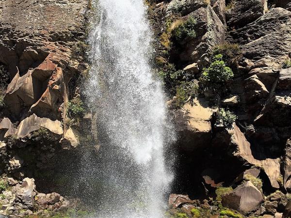
Taranaki Falls
A perennial favourite for locals and visitors alike looking for short, but beautiful, loop walk, the Taranaki Falls track is perfect for families and travellers of all ages and fitness levels. The track offers an excellent glimpse of the varied scenery and landscapes the Tongariro National Park is known for - taking in tussock, bush and ancient lava flows, as it leads to a stunning waterfall. Pack a picnic and enjoy spectacular views of Mt Ruapehu and Mt Tongariro, surrounded by native plants and birdsong. The track also starts on Ngauruhoe Terrace in Whakapapa Village.
Distance: 6km loop
Grade: Easy
Silica Rapids
This highly varied walk travels through mountain beech forest and alongside a cascading stream to arrive at the creamy-white terraces of the Silica Rapids. A range of vegetation types, including subalpine plants, amid a mixture of swamp and tussock country, feature around the track. on a clear day, the walk also has spectacular views of Ruapehu and Ngauruhoe. The track begins 250 metres above Whakapapa Village Visitor Centre, and returns along Bruce Road for 2.5km. Allow 2.5 hours for the return journey.
Distance: 7 km return via Bruce Road
Grade: Easy
Tupapakurua Falls
One of the lesser discovered hikes in the area, but also one of the more challenging, the Tupapakurua Falls track can be reached from National Park Village. It starts off Fishers Road and begins with an easy 20 minute walk to the Taranaki Lookout from where you can view Mt Taranaki on a clear day. From there, it becomes a back-country adventure track suitable for experienced hikers only. The track follows a ridge and then descends steeply to a stream with good stands of native trees, including tawa, mature rimu, miro and totara, along the way. Climbing from the stream, the track winds its way around bluffs to a good lookout point with views of the falls. Allow between 4 to 5 hours for the return trip.
Distance: 11km
Grade: Moderate to difficult
Click here for more information of these and other walks in the area.
Posted in Explore Our World on 16 March, 2019
Latest Posts

Alpine* Vintage & Classic Auto Show

Tongariro National Park – A Year-Round Playground